 |
|
Formule4 - La Terre vue du Sol | |

|
|
|
|
|
Sûˋlecteur Rando
Hike Selector
|
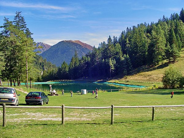
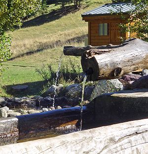
     Lac de La ColmianeTrûô´s agrûôˋable ballade du centre de la station jusqu'au petit lac de la Combe. Pique Nique ûô tous les ûôˋtages, luges les jours de neige, soleil et bancs au rendez-vous. Vous allez surfez (sur l'herbe) car tout l'aller se passe en descente. La glaciûô´re et les paniers vous sembleront moins lourds. Remarquez, vous pouvez aussi descendre en voiture par un autre chemin, mais ce serait dommage de ne pas fouler de vos semelles cette piste de ski. Aprûô´s le repas et la sieste au bord du lac, vous aurez repris des forces pour attaquer la montûôˋe du retour. Very nice walk from station center to the little lake of La Combe. Lunch stop at every floor, sun and banks are witing for you. You will slide on the grass because all the way to go is descending. It will help you to carry your icebox and country chairs. You could also reach the lake by another road, and arrive down with your car. But it would be a pity to not profit from this ski track After the meal, and the nap under the sun, you will recover your forces for back climbing route. Code 13 Nom Lac de La Colmiane Difficultûˋ   Intûˋret Technique  Intûˋret Touristique Kilomûˋtrage Total 2 km Kilomûˋtrage Piste 2 km Durûˋe / Time 00 Jours 02 H 00 min Pays / Country France Dûˋpartement 06NE 4x4 Ouvert/Fermûˋ Open/Closed Praticable 4x4  Praticable VTT / Mountain Bike Praticable Piûˋton / Walking Saison / Season Hors saison de ski - Not during ski season Mise û jour / Updated 2010-04-03 Ville de Dûˋpart - Start from La Colmiane Raids et Routes associûˋs Associated Raids and Routes
|
Updated : 0000-00-00
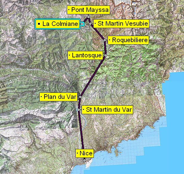
Liaison Nice - La Colmiane : 70 km - 1h15
Way to go Nice - La Colmiane : 70 km - 1h15
A Nice Ouest prendre la RD202 (ancienne RN202) puis remonter vers St Martin du Var et Plan du Var. A la sortie de Plan du Var, bifurquez û droite dans la vallûˋe de la Vûˋsubie sur la D2565. Traversez Lantosque et Roquebilliû´re en direction de St Martin Vûˋsubie. Continuez dans St Martin Vûˋsubie en direction du Borûˋon sur la D2565. A la sortie de la commune, prenez û gauche au carrefour du Pont Mayssa en direction de la Colmiane. Continuez jusqu'û la station. Le dûˋpart se fait face au grand parking au centre de La Colmiane.
From Nice West, drive North on RD202 along the Var River. Cross St Martin du Var and reach Plan du Var. At the end of this village, take on the right in the Vûˋsubie valley on D2565 heading to St Martin Vûˋsubie. Cross Lantosque and Roquebilliû´re, go through St Martin Vûˋsubie and continue on D2565 in direction of Le Borûˋon. Just after the end of St Martin Vûˋsubie, take left at the cross of Pont Mayssa, heading to La Colmiane. Go up to center on this station. Start on the road is just facing the big car park.
Updated : 0000-00-00
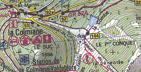
Plan de la Randonûˋe
Map of the Hike Tour
Depuis les terrasses du centre de la station, vous prendrez la route de St Martin Vûˋsubie sur quelques mû´tres pour atteindre le WPT1. Entrez (û pied) sur l'aire herbeuse parsemûˋe de jeux pour enfants. Vous descendrez la piste (eh oui la piste) jusqu'au plan du WPT2. Tournez û gauche pour rejoindre le lac, WPT3. Vous reviendrez par le mûˆme itinûˋraire.
From the center of the station, take the road to St Martin Vûˋsubie on ten meters and enter on your right in the grass area at WPT1 where stand many children's games. Go down walking the splendid track and reach WPT2. Then on your left, you can join the lake at WP3. You will come back by the same way.
Updated : 0000-00-00
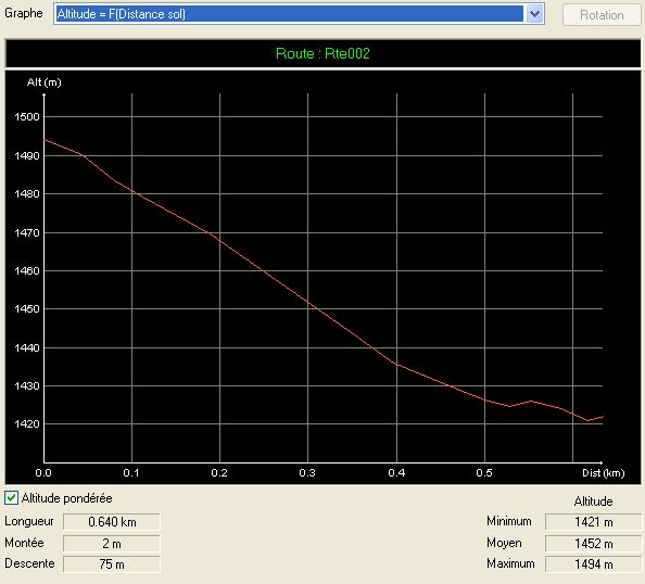
Profil Altitude : ca descend ! et ca remonte au retour
Altitude Profil : all way down but all way back up
 Road Book - Waypoints

| Nô¯ | Codec | Nom | Latitude | Longitude | Altitude |
| 1 | 1STATN | Sation Colmiane | N 44ô¯04'15 | E 007ô¯13'25 | 01494 m |
| 2 | 2CONQT | Conquet | N 44ô¯04'10 | E 007ô¯13'44 | 01430 m |
| 3 | 3LACOL | Lac de Colmiane | N 44ô¯04'11 | E 007ô¯13'50 | 01422 m |
Updated : 0000-00-00
WPT 1 : Dûˋpart de la rando û partir de la station
WPT 1 : Start of the hike from the station
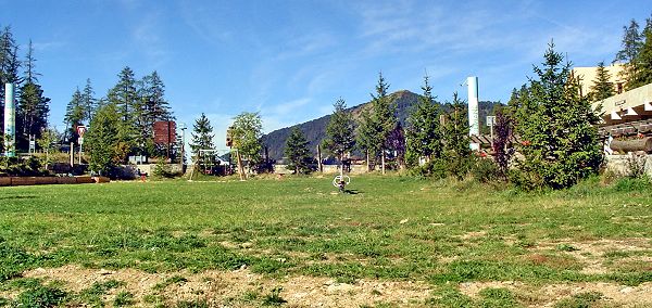
Depuis la place centrale de La Colmiane, lû oû¿ vous avez du garer la voiture, prenez la route vers St Martin Vûˋsubie sur quelques mû´tres. Sur votre droite, vous voyez une grand aire herbeuse couverte de jeux pour enfant. C'est lû que commence votre aventure.
From central place of La Colmiane, where you have parked the car, take the road to St Martin Vesubie for ten meters an enter at your right in the grass area where stand several games for kids. This is your start or the great little adventure.
Accûˋdez û cette route du Raid
Go to this route of the Raid
Updated : 0000-00-00
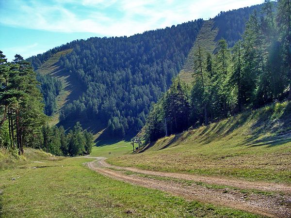
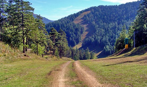
Une douce descente
A sweet way down
 Updated : 0000-00-00 Surtout suivez bien l'unique chemin
Dont loose your way on the single track
|
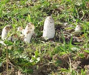 Updated : 0000-00-00 Attention û la cuillette
Watch out to what you would pick
|
|
Aprû´s quelques mû´tres de descente, vous retrouvez trû´s vite la solitude immense de la montage, toute relative d'ailleurs car il y a souvent du monde, surtout le week end. Vous marchez sur un doux tapis herbeux malgrûˋ la dûˋception de ne pas appuyer vos pneux sur cette magifique piste. Mais franchement, ce n'est vraiment pas l'endroit pour jouer les pilotes de rallye.
After some meters down you will feel the solitude of the mountain, all relative because there are often people, specially on saturday and sunday. Walk on the comfortable grass carpet, with a little despite to not press your tires on this fabulous track. But really, this is not the right place for Rallye Raid.
|
|
Updated : 0000-00-00
Un admirable point de vue plein de sûˋrûˋnitûˋ
Wonderfull feeling of serenity
Quelle sensation que de se laisser guider par la descente. Bon, en principe c'est une ballade û pied et la voiture doit rester garûˋe sur le parking plus haut. Puisqu'on vous le dit !
What a nice sensation to let you slide down. Yes, normally this is a walking tour and your car must be parked on the park. That is told !
Updated : 0000-00-00
Un coup d'oeil en arriû´re pour constater qu'au retour, ûÏa va monter
Go down is easy but a back looking will warn you of the difficult back way
Updated : 0000-00-00
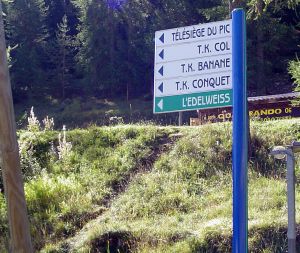
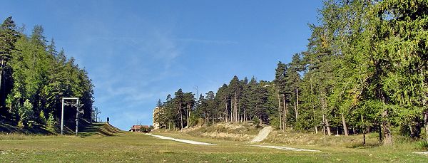
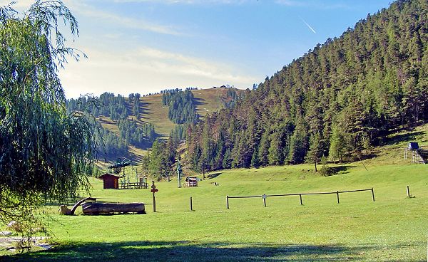
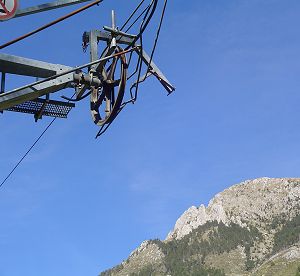
Waypoint 2 Bachasses Le Conquet
Waypoint 2 Bachasses Le Conquet
N'allez pas faire la queue au tûˋlûˋski. Il n'y a personne mais vous attendriez longtemps. Observez bien : il n'y a pas de neige mais certainement des chevaux, des vaches, des chû´vres...
Dont wait for the skilift to climb up. You would be disapointed. Look good around you. There is no snow but probably horses, cows or goats...
Updated : 0000-00-00
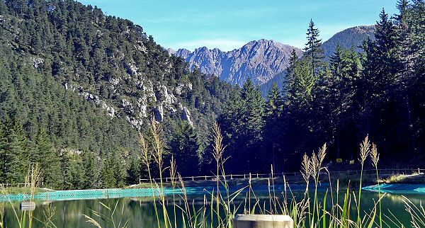
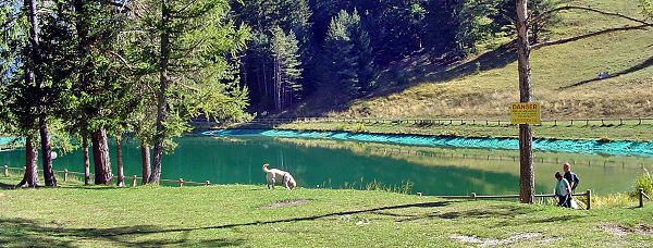
L'approche du lac : un havre d'ûˋquilibre pour les yeux
The lake approach : perfection of the landscape
Updated : 0000-00-00
Les berges du lac
Bank of the lake
Une petite trempette ? Un petit tour romantique autour de la jolie flaque ? Le chien qui fait des ronds dans l'eau ? N'enviez pas ceux qui sont descendus en voiture (par l'autre chemin), ils n'ont pas connu votre plaisir de descendre û pied. Et ils auront l'air malin û remonter sans souffrir et suer.
A little bath ? A little romantic walk around ? Let the dog make circles in the water ? Dont envy the ones who get down by car (by the other track), they missed your enjoyment to go down by feet. And they will look a little stupid to climb back without pain and sweat.
Updated : 0000-00-00
WPT 3 Vous voulez vraiment vous baigner ?
WPT 3 Do youwant really to take a bath ?
Oui, bon, franchement la couleur de l'eau n'incite pas vraiment û la baignade. Laissez le chien (ou votre lapin) s'amuser dans l'eau et restez sagement sur la rive. Des lacs de montagne oû¿ on peut se baigner, il y en a d'autres.
Really, the color of the water is not a nice invitation to swim in. Let your dog (or your prefered rabbit) go to have fun in the lake while you stay nicely on the edge. There are several other mountain lakes where you can swim nicely better.
Updated : 0000-00-00
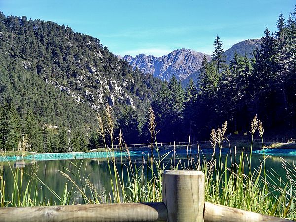
Faites le tour de ce merveilleux endroit
Turn around this marvellous place
Profitez de ce merveilleux endroit pour dûˋjeune, diner ou souper selon la saison, et sortez l'appareil photo, la camûˋra, le prtablonophotovidûˋo. La douceur de cette prairie est franchement fabuleuse.
Enjoy this fabulous quiet place and make all pictures and video you want. Have lunch, or diner if the season allows it.
 Updated : 0000-00-00 |
 Updated : 0000-00-00 |
|
La ballade est presque terminûˋe. Il ne vous reste qu'û ... remonter jusqu'û la station. Pas de panique. Une petite demi-heure (une heure pour les plus fûˋnûˋants) de souffrance sous le soleil suffira û vous rapprocher des terrases et des restaurants... tout lû haut. Prenez le mûˆme chemin qu'û l'aller... mais en sens invers
The trip is quite finished. You need just to... climb back to the village. Only half an hour of difficult climb under the sun and you will reach again the sympathic terrasses of the cafûˋs and the restaurants in the station. Take the same track than to come but in the reverse way.
|
|
Raids
| Route | Colmiane Venanson | DifficultÕ 2 | Technique 2 | Tourisme 4 |
Formule 4 Formule4 is JAVA free - Pas d'applet JAVA sur Formule4 sitemap
|
|