 |
|
Formule4 - La Terre vue du Sol | |

|
|
|
|


Updated : 0000-00-00
Liaison Nice - Fort de la Revère
Way to go Nice - Fort de la Revère
Accédez à la Grande Corniche que vous emprunterez pour jouir de l'exceptionnel panorama de cette route exceptionnelle. Passez le Col des 4 chemins et continuez jusqu'au Col d'Eze. Vous prendrez à gauche en direction de l'Astrorama puis du Fort de la Revère. Un grand parking vous attend au bout de la route.
Take the Grande Corniche at the east of Nice then climb to Col des 4 chemins and continue to Col d'Eze. There, take the little road on your left and climb heading to Astrorama then upper to Fort de la Revere. A big Car Park wait for you at the end of the road.
Accédez à cette route du Raid
Go to this route of the Raid
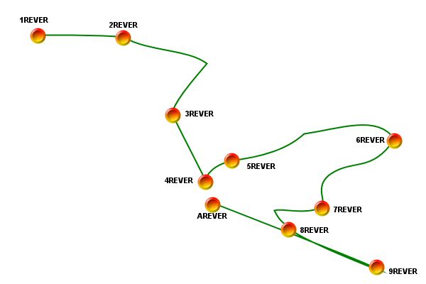
 Road Book - Waypoints

| N° | Codec | Nom | Latitude | Longitude | Altitude |
| 1 | 1REVER | Entrée du Parc | N 43°44'23 | E 007°21'46 | 00681 m |
| 2 | 2REVER | Sortie du Parc | N 43°44'19 | E 007°22'01 | 00689 m |
| 3 | 3REVER | Carrefour | N 43°44'16 | E 007°22'05 | 00660 m |
| 4 | 4REVER | Plateau des pistes | N 43°44'13 | E 007°22'12 | 00644 m |
| 5 | 5REVER | Chemin de découverte | N 43°44'13 | E 007°22'14 | 00645 m |
| 6 | 6REVER | Pointe Est | N 43°44'12 | E 007°22'30 | 00634 m |
| 7 | 7REVER | Point de vue | N 43°44'08 | E 007°22'22 | 00651 m |
| 8 | 8REVER | Tunnel Est | N 43°44'07 | E 007°22'19 | 00643 m |
| 9 | 9REVER | Route Simboula | N 43°44'09 | E 007°22'27 | 00632 m |
| 10 | AREVER | Fin de rando | N 43°44'12 | E 007°22'12 | 00642 m |
Updated : 0000-00-00
Plan de la Randonée
Map of the Hike Tour
Updated : 0000-00-00
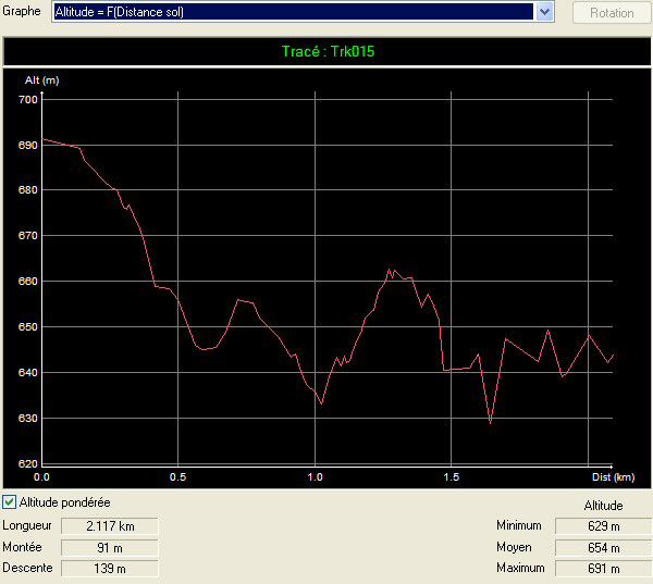
Profil Altitude de la randonnée
Altitude Profil of the hike tour
Updated : 0000-00-00
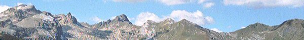
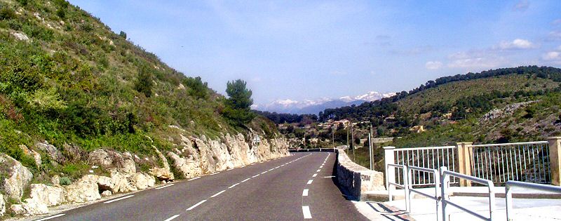
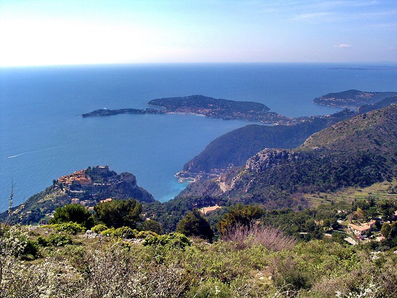
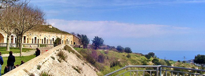
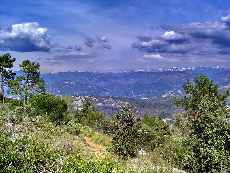
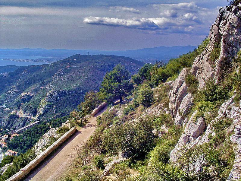
La Grande Corniche
The Grande Corniche
A un kilomètre du Col d'Eze vous découvrez ce spendide panorama avec les montagnes enneigées (en certaines saisons) sur l'horizon.
One kilometer before the Col d'Eze, discover this fabulous landscape with snowered mountains (in some seasons) at the horison.
Updated : 0000-00-00
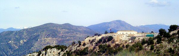
Col d'Eze
Col d'Eze
Au col vous découvrez mieux le paysage fantastique avec au premier plan le Fort de la Drête.
At the col you can see better the landscape with, in the foreground, the Fort de la Drête.
Updated : 0000-00-00
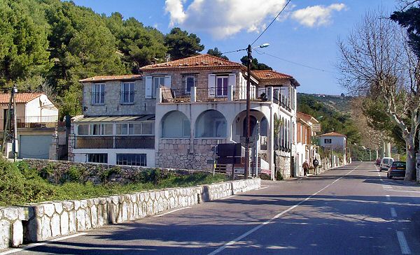
Tournez à gauche
Turn to the left
Ce restaurant, facilement reconnaissable, indique l'accès de la route vers le Fort. Vous prendrez à gauche. A droite, la route descend vers le village d'Eze.
This restaurant is easy to see on your left. It marks the road to the left to climb to the Fort. At your right is a road that goes down to Eze village.
Updated : 0000-00-00
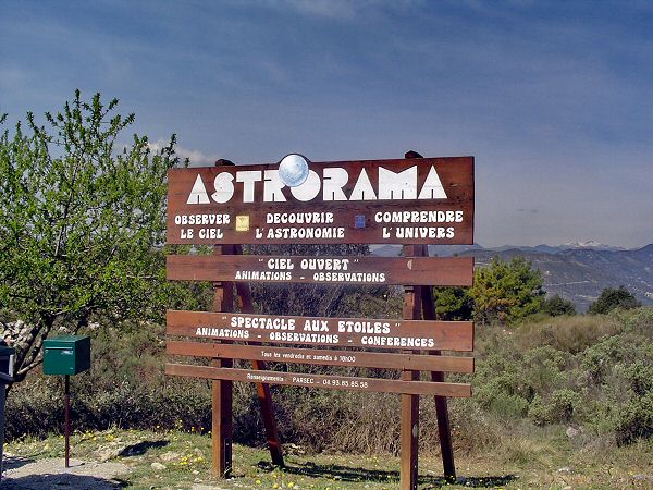
Sur votre route, l'Astrorama
On your road, the Astrorama
L'Astrorama est un lieu de rendez-vous pour les astronomes amateurs. Vous le laisserez sur votre gauche et continuerez à monter vers la droite
The Astrorama is a meeting place for people interested by astronomy. You will let this place on your left and climb up on your right.
Updated : 0000-00-00
L'Astrorama
The Astrorama
Updated : 0000-00-00
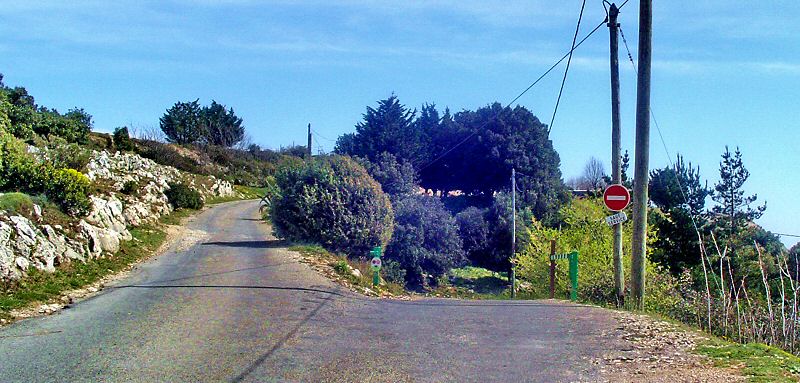
L'accès à la piste est interdit
The access to the track is not allowed
Vous devez prendre à gauche vers le parking. L'accès à la piste de la Simboula se fait à droite mais c'est fermé par une barrière et l'accès est interdit en voiture.
You have to go to te left, to the parking. On the right you could go on the track of the Simboula but it is locked by a gate and it is forbidden by car.
Updated : 0000-00-00
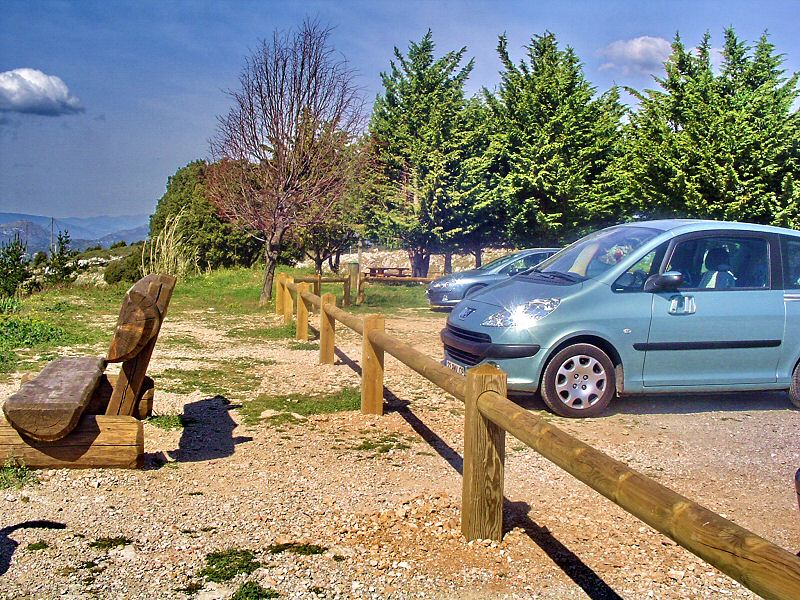
Le parking
The Car Park
Updated : 0000-00-00
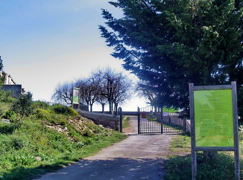
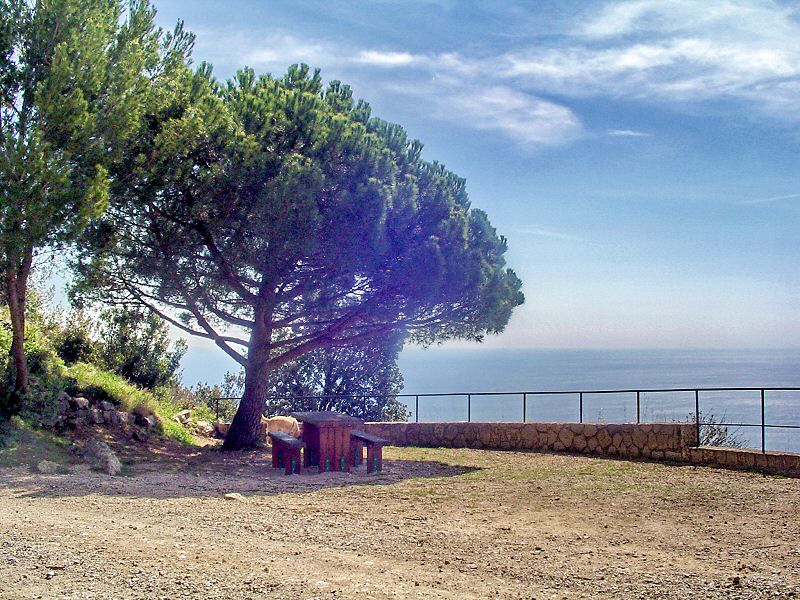
WPT1 Entrée du parc du Fort de la Revère
WPT1 Entrance of the park of the Fort de la Revère
La grille indique l'entrée du petit parc aménagé qui fait face au fort lui-même. Un splendide endroit pour le soleil, la vue et un pique nique bien agréable, chaud et frais à la fois.
The gate opens the route in a little park fitted up for lunch on the grass or on displayed tables and benches. Facing to the Firt itself, a very nice place, warm and fresh at same time.
Updated : 0000-00-00
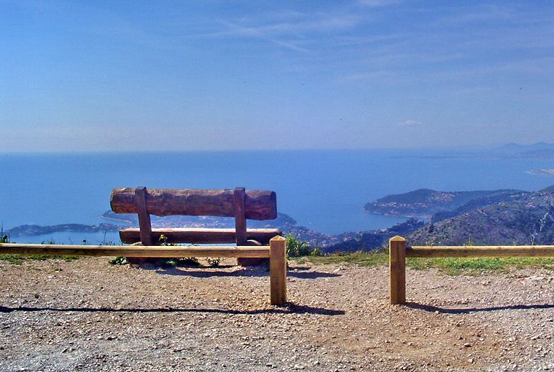
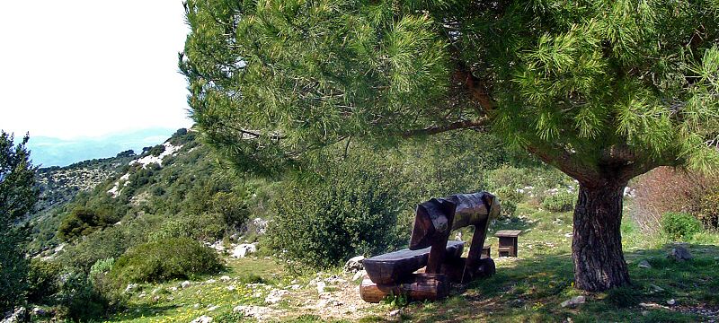
Avant de commencer la randonnée
Before to start the tour
profitez de l'exceptionnel panorama, un des plus beaux à proximité de Nice. Ce banc vous tend les bras.
take pleasure of the exceptional ladnscape, one of the most famous around Nice. This bench is waiting for you.
Updated : 0000-00-00
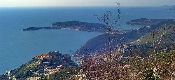
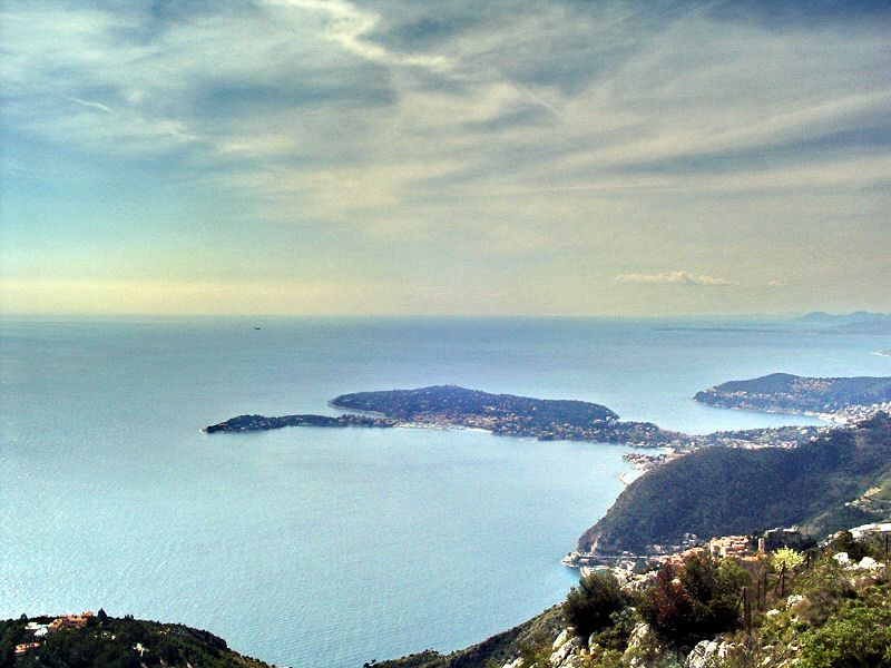
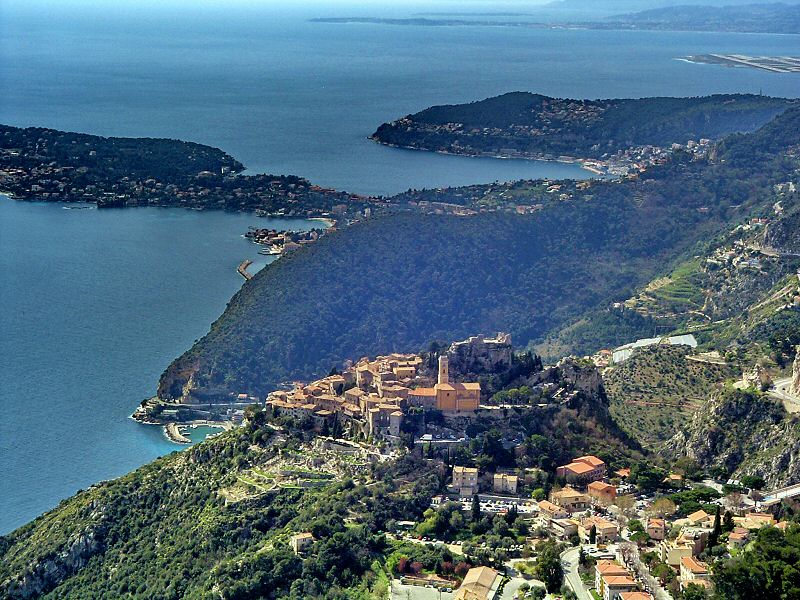
Un des plus beaux panorama autour de Nice
One of the most famous landscape around Nice
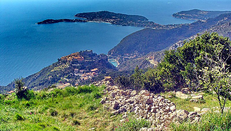
Une fois assis, profitez de votre vue. A gauche, le village d'Eze perché sur son piton rocheux. La presque ile qui s'avance dans la mer, c'est St Jean Cap Ferrat et ses luxueuses propriétés. Juste à droite, le Cap de Nice et, au fond, le Cap d'Antibes. Profitez du panorama QTVR ci-dessous.
Once you are sit, enjoy your view. On the left, Eze village, the peninsula is St Jean Cap Ferrat and its marvelous villas, just on its right is Cap de Nice and in the background Cap d'Antibes. Watch the interactive panorama QTVR by clicking the link under.
Accédez à cette route du Raid
Go to this route of the Raid
Updated : 0000-00-00
C'est parti pour la ballade
It's gone for the hike tour
Updated : 0000-00-00
Le Fort depuis l'entrée du parc
The Fort seen from the entrance of the park
Accédez à cette route du Raid
Go to this route of the Raid
Updated : 0000-00-00
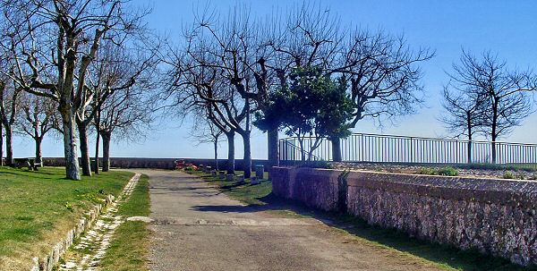
Allée du parc
The alley in the park
Updated : 0000-00-00
Accès à la parite Ouest du Fort
Go to West side of the Fort
Updated : 0000-00-00
Partie Nord : impossible d'entrer
North side : no entry possible
Updated : 0000-00-00
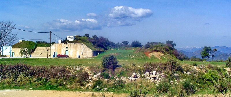
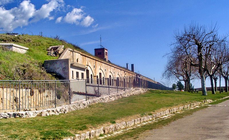
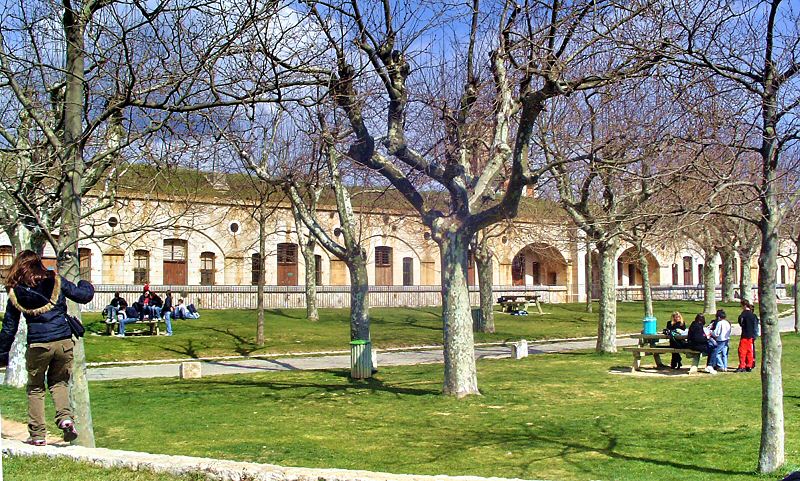
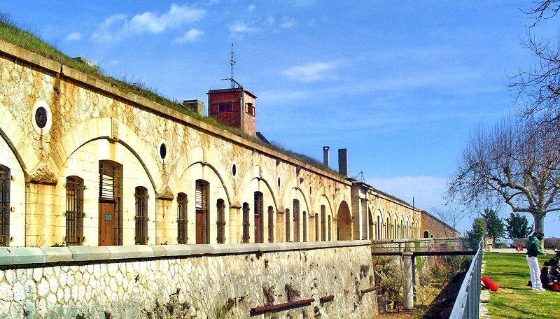
Le Fort vue de face
Face view of the Fort
Depuis la table d'orientation, on a une vue générale sur la facade sur du Fort de la revère. De nombreux endroits sont aménagés pour le pique-nique.
From the orientation table you have a general overvie on the south side of the Fort. Several tables and benches are displayed for lunch in the park.
Updated : 0000-00-00
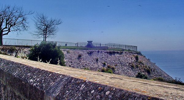
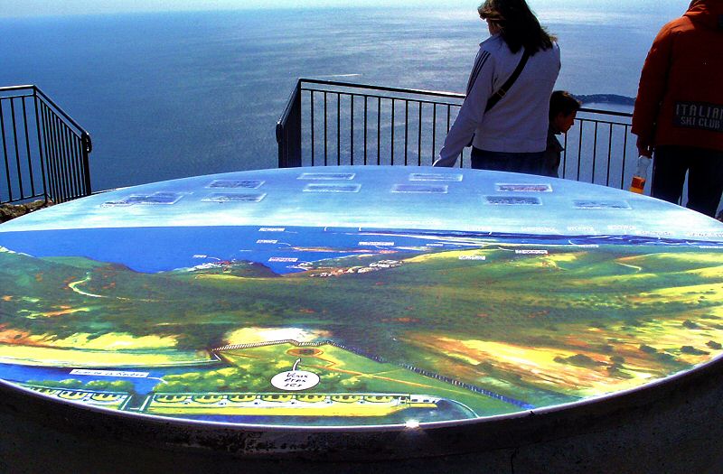
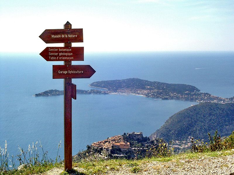
Table d'orientation
Orientation table
Un promontoire supporte la table d'orientation pour une vue dégagée à 360 degrés. Pour découvrir toute la vue, accédez à notre QTVR ci-dessous.
The orientation table open a 360 degrees panorama on all the coast and background mountains. Go to our QTVR on the link under to watch the full landscape.
Accédez à cette route du Raid
Go to this route of the Raid
Updated : 0000-00-00
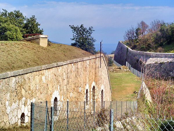
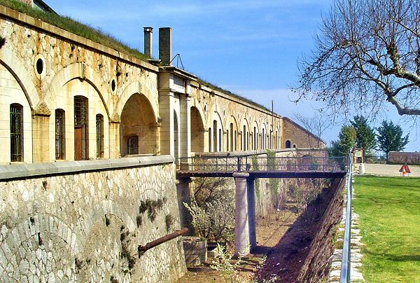
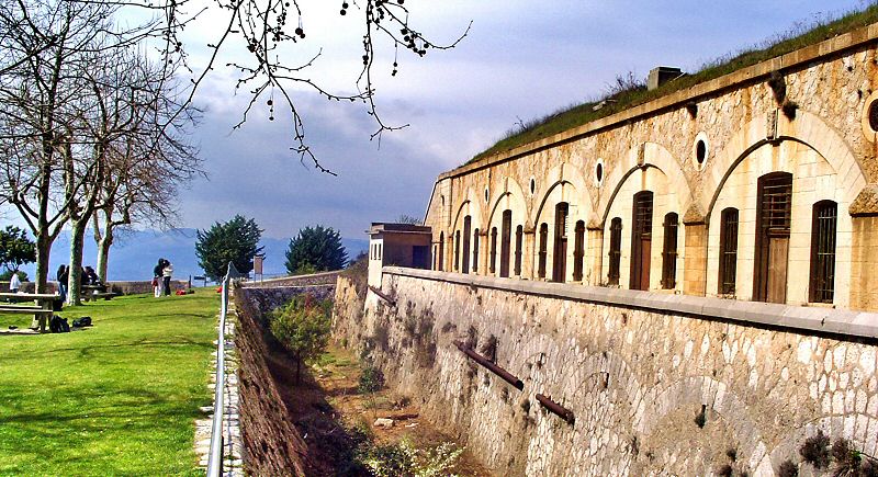
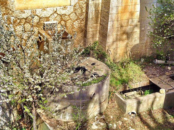
Facade et douves
South face and moats
Updated : 0000-00-00
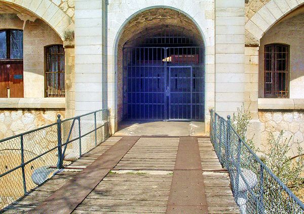
Le pont d'accès
The access bridge
Updated : 0000-00-00
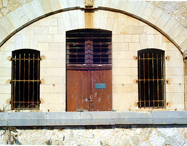
Une des salles de facade fermées
One of the facing rooms closed
Updated : 0000-00-00
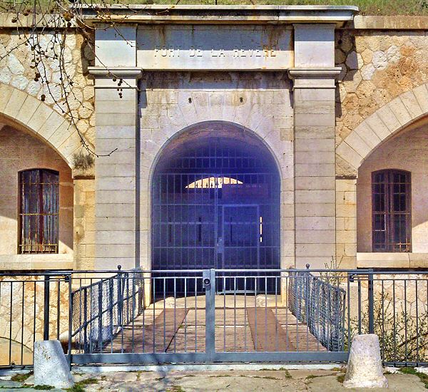
Entrée du Fort
Entrance gate of the Fort
Updated : 0000-00-00
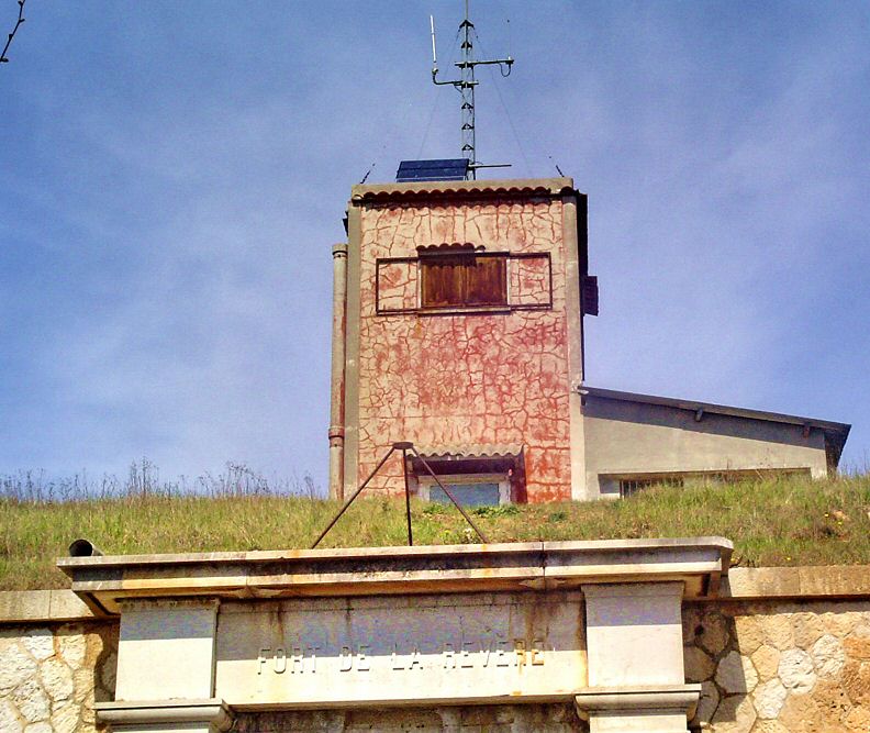
Etrange tour de vigie
Strange look-out tour
Updated : 0000-00-00
Le pont est praticable mais l'accès est verouillé
The bridge is usable but access is locked
Updated : 0000-00-00
Partie ouest de la facade avec sa douve
West part of the facing side with its moat
Updated : 0000-00-00
Détail des douves
Detail of the moats
Updated : 0000-00-00
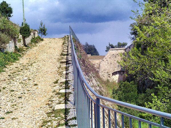
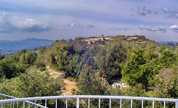
Partie Est du parc du Fort
East part of the park of the Fort
Continuez vers l'est et traversez le parc pour atteindre le WPT2.
Continue to the East to cross the park and reach WPT2.
Updated : 0000-00-00
WPT2 sortie du parc
WPT2 outway of the park
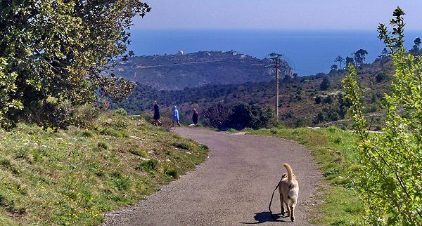
Vous commencez vraiment à marcher puisque vous allez descendre une pente ni trop facile ni trop raide. Que du bonheur.
You will start really to walk there by descending a road not to sharp and not too soft. Only happyness.
Updated : 0000-00-00
Le début de la piste est en bas à droite du poteau
Start of the track is down by the right of the post
Updated : 0000-00-00
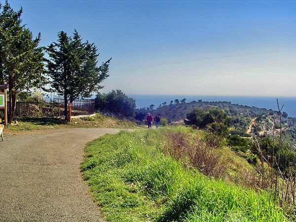
Impossible de se perdre : suivez la route
No possibility to loose your way : follow the road
Updated : 0000-00-00
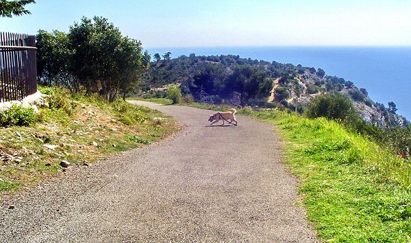
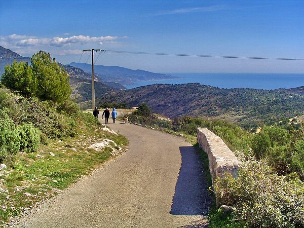
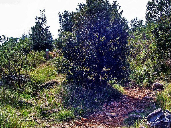
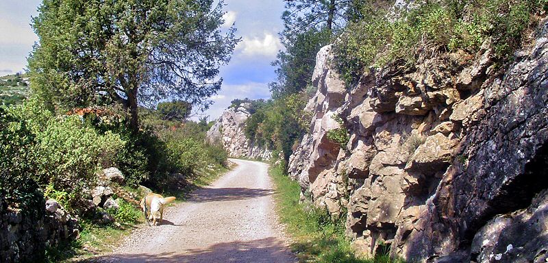
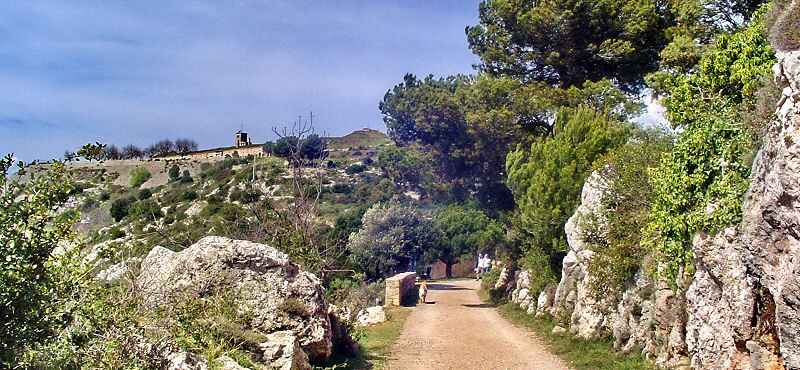
A chaque détour une carte postale
A postcard each time you turn your head
Updated : 0000-00-00
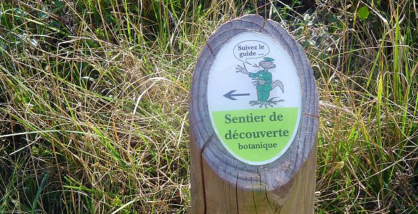
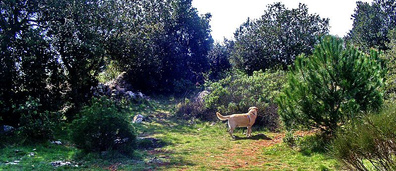
Suivez Monsieur Tim, votre guide
Follow Mr Tim, your guide
Updated : 0000-00-00
Continuez à descendre et suivez la route
Continue to go down on the road
Au virage, à gauche, un sentier mène à un affût d'où vous pourrez photographier la vie des oiseaux présents sur les lieux. Pour la ballade, continuez à droite sur la route.
At the curve, on the left, a little track brings you to a covered place from where you can make photographies of birds around. To continue the walking, take the road on the right.
Updated : 0000-00-00
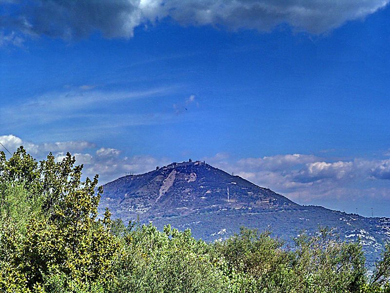
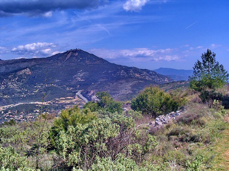
Vue sur l'impressionnant Fort du Mont Agel
The impressive Fort of Mont Agel
Updated : 0000-00-00
WPT3 Tournez à gauche et descendez
WPT3 Turn to the left and go down
Au WPT3 vous retrouvez la route inférieure bloquée par une barrière que vous avez aperçue avant le parking. Tournez à gauche et continuez à descendre vers la piste.
At WPT3 you join the road locked by the gate you saw before the car park when you arrived. There, turn on your left and go down to the track.
Updated : 0000-00-00
Au WPT3 tournez à gauche
At WPT3 turn on your left
Updated : 0000-00-00
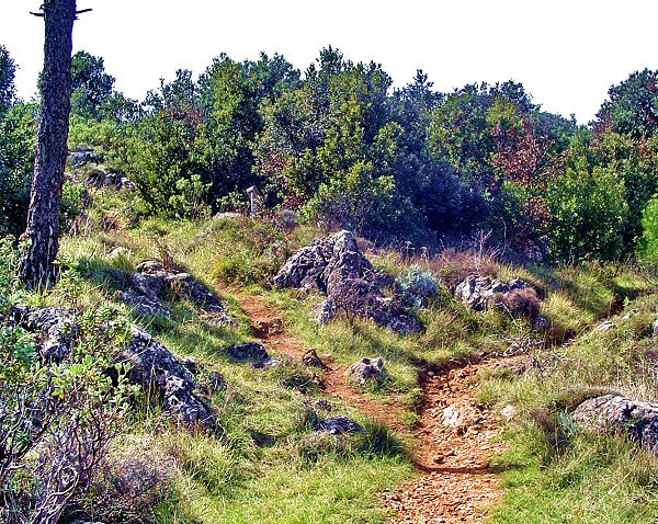
Aucun problème pour descendre
No problem to go down
Updated : 0000-00-00
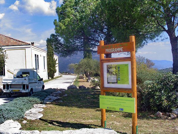
Sur votre gauche la Maison de la Nature
The House of Nature on your left
Updated : 0000-00-00
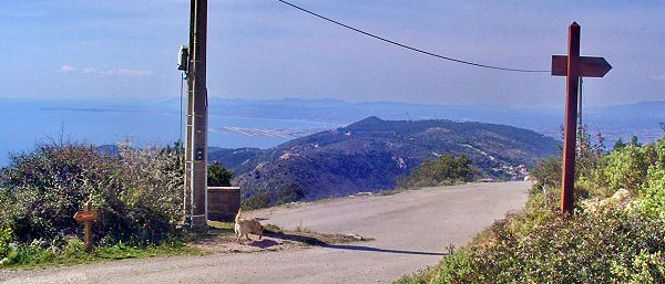
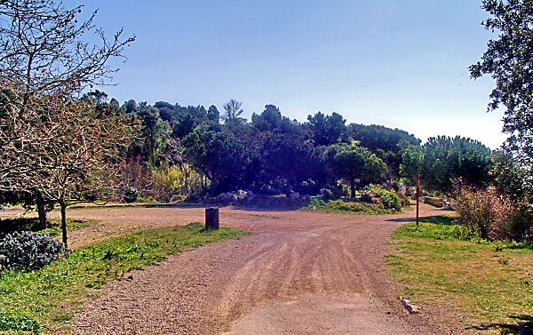
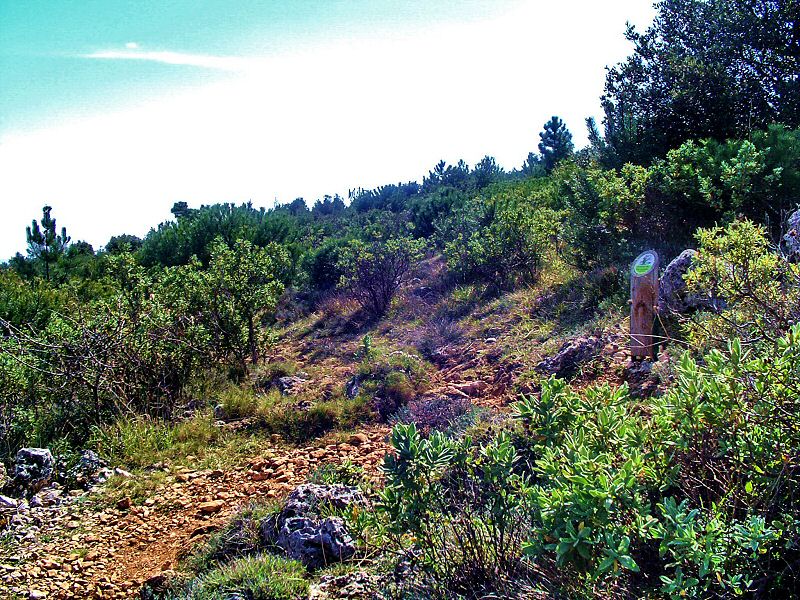
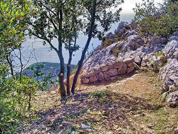
WPT4 Début de la piste
WPT4 Start of the track
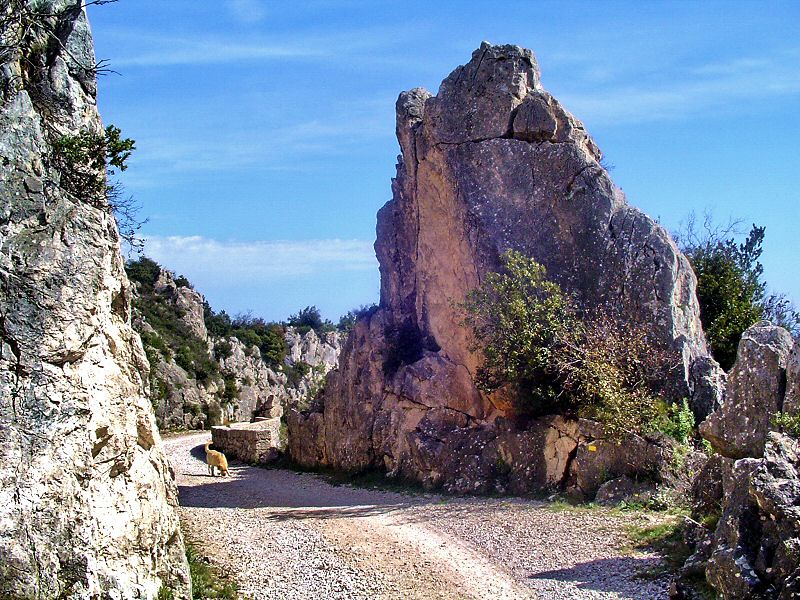
Vous arrivez sur le petit plateau d'où partent diverses pistes. Tout à gauche une large piste qui descend vers l'autoroute. Tout à droite, la route de la Simboula, merveilleuse piste praticable en 4x4 et merveilleusement interdite à la circulation. Un peu à gauche et un peu à droite, commence le sentier de découverte, c'est celui de notre ballade.
At this place several large tracks start. One big on the left goes down to the highway. On big on the right is a fabulous route de la Simboula, worderfull track usable in 4WD and nicely forbidden to vehicles. We will take a little on the left and a little on the right on the discovery path to continue the hike.
Updated : 0000-00-00
Tournez à gauche
Turn on your left
Une fois sur la place, tournez à gauche. Face à vous, la large piste qui descend un peu vers la gauche. Notre sentier démarre sous les pins juste après le panneau vert.
Once on the place, take to the left. Face to you, the large track goes a little to the left. Our track starts under the pin trees, just after the green panel.
Updated : 0000-00-00
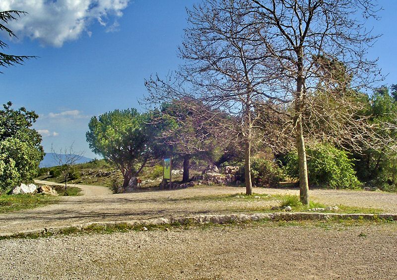
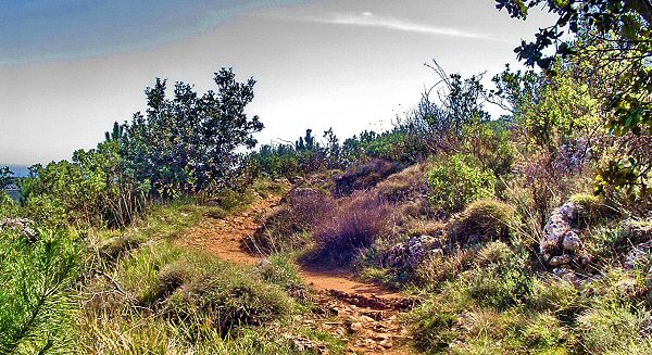
WPT5 Début du sentier de découverte
WPT5 Start of the Discovery Path
Ici commencent les choses sérieuses. Ne ratez pas l'accès au sentier. Juste après le panneau sur votre droite, c'est bien indiqué. Idéal à pied, ce sentier est difficilement praticable en VTT et ne présente aucun intérêt technique. Si vous voulez faire du vélo peinard, prenez plutôt la route de la Simboula (la piste droite au WPT4).
Here start real adventure. Dont miss the entrance of the path, just after the green pannel on your right. There is an arrow to show you the way. Very nice by walking, this track is difficult with mountain bike and have no technical interest. If you came here to ride, take better the route de la Simboula, the right track on WPT4.
Updated : 0000-00-00
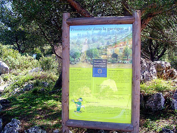
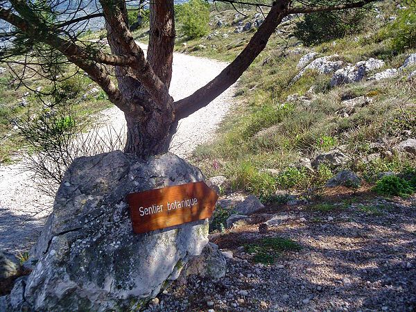
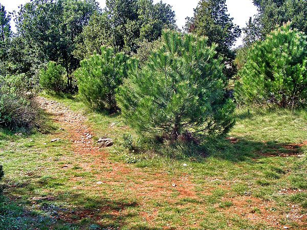
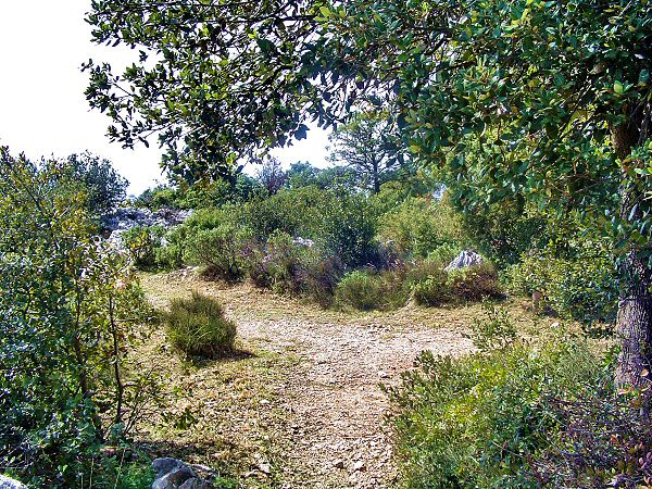
Sentier botanique
Botanical path
Accédez à cette route du Raid
Go to this route of the Raid
Updated : 0000-00-00
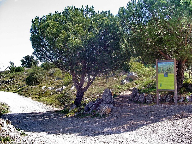
L'entrée du sentier de découverte est bien visible
Entrance of the discovery path is easy to find
Updated : 0000-00-00
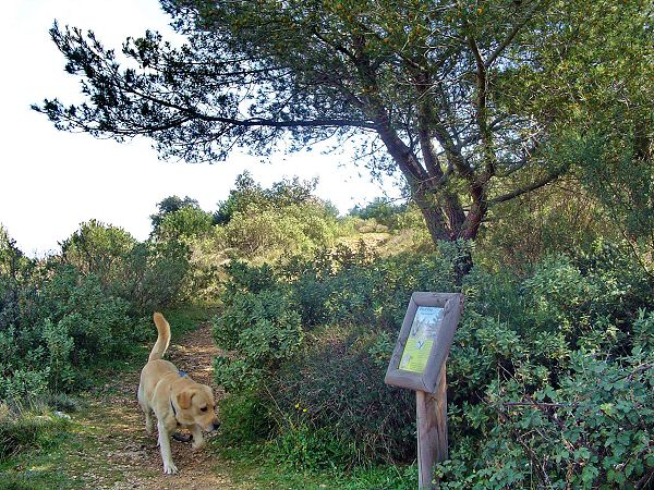
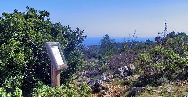
Remarquez les panneaux d'informations intégrés au paysage
Info panels are integrated in the landscape
Updated : 0000-00-00
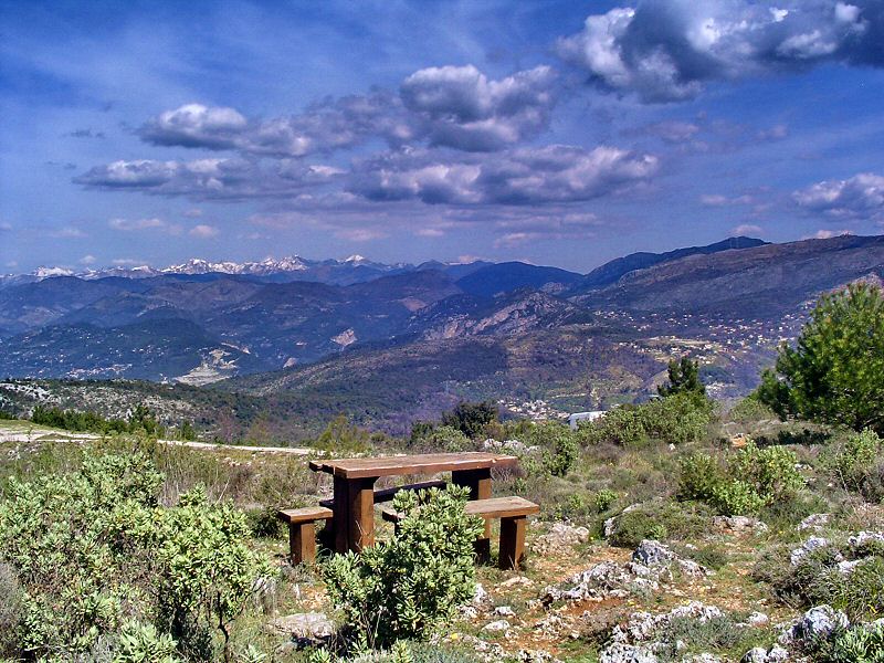
Un déjeuner avec vue
For a lunch with overview
Updated : 0000-00-00
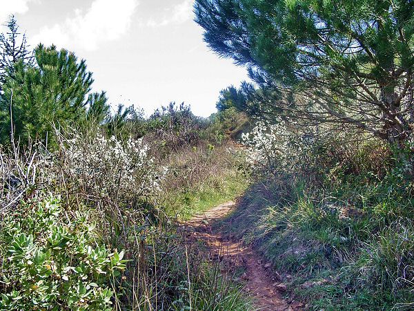
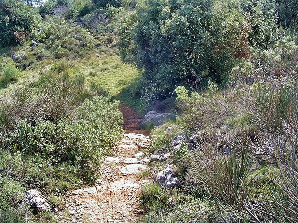
Le chemin devient vite étroit et isolé
The path becomes quickly narrow and lonely
Updated : 0000-00-00
Jusque là impossible de vous perdre, suivez la piste
Untill there no possibility to be loosed, follow the track
Updated : 0000-00-00
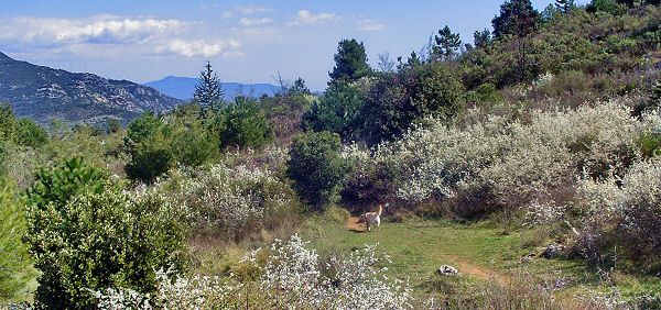
Selon la saison, la floralité varie et peut surprendre
Following differetn seasons flowering can change and surprise you
Updated : 0000-00-00
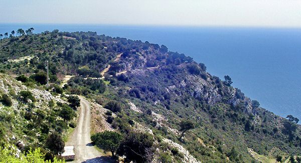
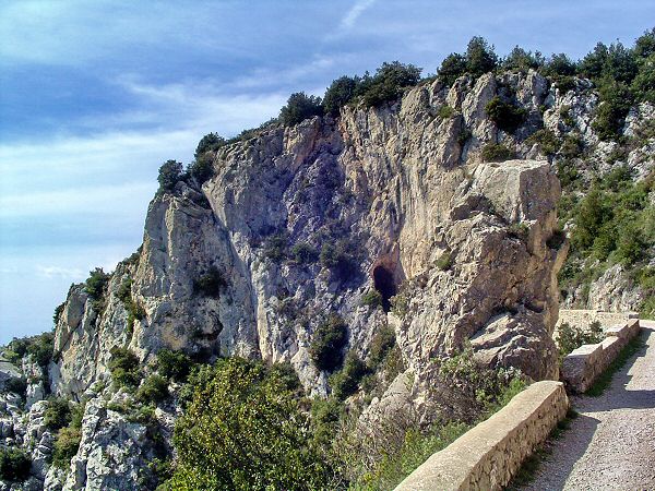
La vue se dégage : en bas l'autoroute A8, en haut le Mont Agel
The panorama is clear : down the highway, up the Agel Mountain
Updated : 0000-00-00
Chaque panneau de découverte est une infoprmation botanique
Each panel is a botanical information
Updated : 0000-00-00
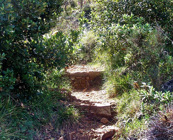
La piste n'est pas difficile malgré quelques marches
Just some steps but the track is not difficult
Updated : 0000-00-00
Suivez le guide
Follow the guide
Updated : 0000-00-00
Attention : prendre le sentier à droite
Look out : take the path on your right
Updated : 0000-00-00
Le chemin remonte légèrement
The path climbs slowly
Updated : 0000-00-00
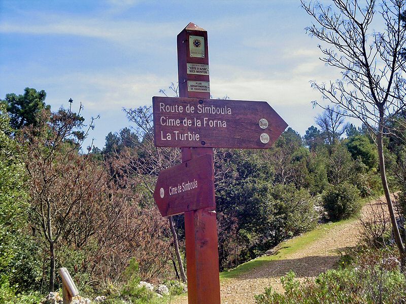
WPT6 Pointe extrême Est de votre ballade
WPT6 Extremal East point of the trip
Profitez du paysage éblouissant et découvrez le dans le Panorama ci-dessous, mais ne ratez pas la borne sur votre droite. C'est par ce sentier à droite que vous continuerez la route.
Take a look at the landscape and watch it in the Panorama just under, but don't miss the panel on your right. It is by this path that you will continue the hike.
Accédez à cette route du Raid
Go to this route of the Raid
Updated : 0000-00-00
Cette fois la piste remonte franchement. Courage...
Be strong. The track climbs up really now.
Updated : 0000-00-00
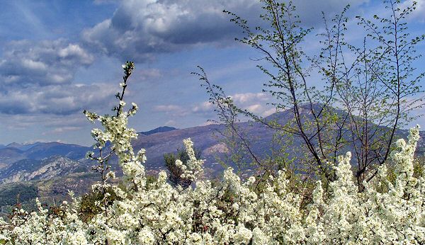
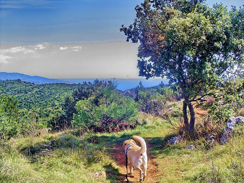
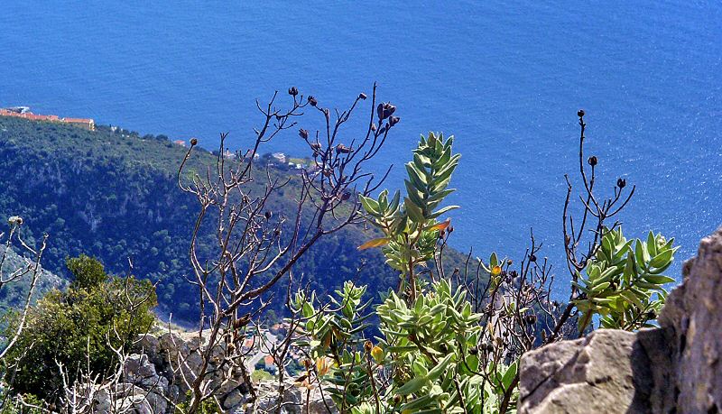
L'arrière pays et les cîmes enneigées
The backland and snowed up peaks
Updated : 0000-00-00
Regardez bien à gauche, le poteau guide. C'est par là !
Look well on your left the guide panel shows the way
Updated : 0000-00-00
Prenez à droite puis à gauche
Take right then left
Pour ne pas vous perdre à cet endroit, repérez le panneau d'information botanique. Il se trouve légèrement à gauche, au milieu de la hauteur, juste sous les arbres. Suivez donc la piste à droite puis très vite bifurquez à gauche.
You must recognise the botanic info panel, in the middle left, just undre the trees. To reach this panel, follow the right track then quickly the next track on your left.
Updated : 0000-00-00
Le chemin à gauche est pourvu de quelques marches
The next path on the left has several steps
Updated : 0000-00-00
Traversez la clairière et continuez tout droit
Cross the glade and continue straight on
Updated : 0000-00-00
Suivez le chemin face à vous qui sort de la clairière
Follow he track face to you. It brings you out of the glade
Updated : 0000-00-00
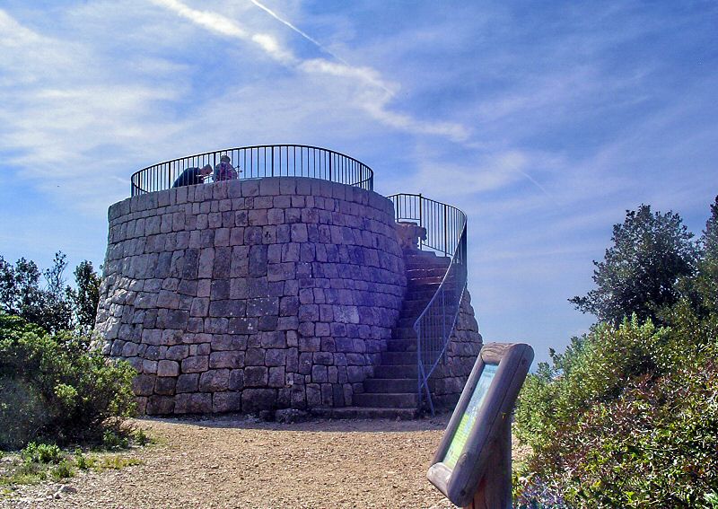
WPT7 Tour du Point de Vue
WPT7 Tour of the Point of View
Vous avez bien mérité de grimper les quelques marches pour admirer le panorama d'en haut.
You are allowed to climb the several steps to enjoy the Panorama up the tour.
Updated : 0000-00-00
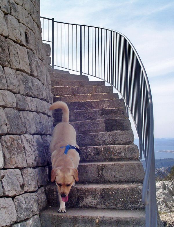
Soufflez un bon coup et attaquez l'escalier
Breath deeply and run up the stairs
Updated : 0000-00-00
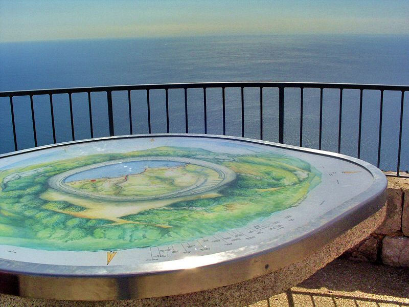
Bleu, Azur, Mer, Air, la table d'orientation du point de vue
Blue, Azur, Sea, Air, the orientation table of the tour
Updated : 0000-00-00
Du Cap Ferrat à l'Estérel
From Cap Ferrat to Esterel mountains
Updated : 0000-00-00
Le Fort de la Revère visible depuis la tour
The Fort is visible from the tour
Updated : 0000-00-00
Tout à fait à droite vous apercevez la piste que vous allez suivre
All on the right you can see the track you will follow very soon
Updated : 0000-00-00
Suivez la piste qui part à droite de l'escalier
Follow this path at the right of the stairs
Updated : 0000-00-00
Cent mètres plus loin prenez vers la gauche pour redescendre
Hundred meters farther take on the left to go down to Simboula track
Updated : 0000-00-00
Juste derrière ces arbres se trouve la rampe de descente vers Simboula
Just behind these trees is the way down to Simboula track
Updated : 0000-00-00
La rampe et ses lacets. En bas, la piste Simboula
The way down and its curve pins. Down is the Simboula Track
Updated : 0000-00-00
En bas votre chemin de retour, au loin à gauche les pistes de l'aéroport de Nice
Down your path back, far on the left the Nice Airport
Updated : 0000-00-00
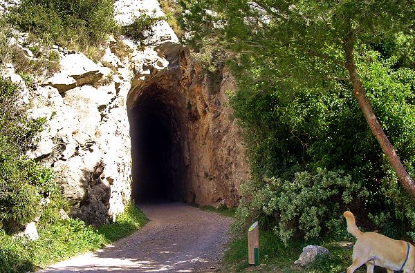
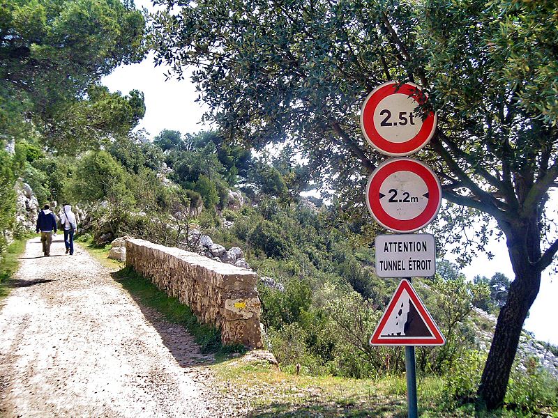
WPT8 Pause casse croute avant le tunnel
WPT8 Lunch pause before the tunnel
Connaissez-vous en endroit plus charmant pour faire une pause et boire un petit coup ? Profitez du soleil car dans quelques instants vous affronterez l'obscurité effrayante du tunnel. La ballade se continue à gauche.
Do you know any other place so charmant to dring a little cup of tea ? Enjoy the sun because you will reach the frightening darkness of the tunnel. The hike continues on your left.
Updated : 0000-00-00
Eze, St Jean Cap Ferrat puis les pistes de l'aéroport
Eze village, St Jean Cap Ferrat then the Airport
Updated : 0000-00-00
Armez vous de courage et entrez dans les ténèbres
Don't be afraid and enter in the darkness
Updated : 0000-00-00
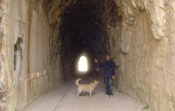
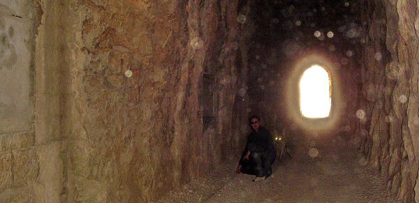
Voila : rien de bien méchant. On y voit quand même un petit peu
Nothing really bad. You can have some little light to see where go your feet
Updated : 0000-00-00
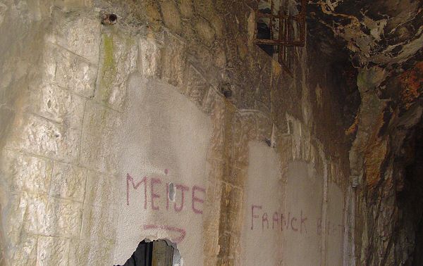
D'ancien usage militaire, les casemates sont murées
From old military usage, barricks are now closed
Updated : 0000-00-00
Prenez votre temps, faites des photos inoubliables
Take your time and make unforgettable pictures
Updated : 0000-00-00
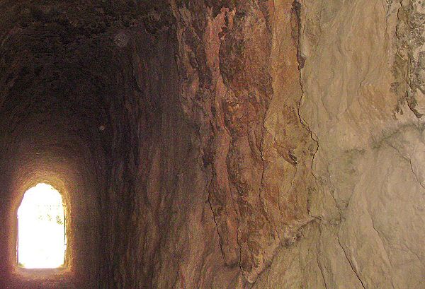
Le tunnel est creusé à même la roche
The tunnel is digged through the roc
Updated : 0000-00-00
Ouf, c'est fini, sauf qu'il faudra y repasser pour rentrer
The light again but you will have to cross the tunnel again the way back
Updated : 0000-00-00
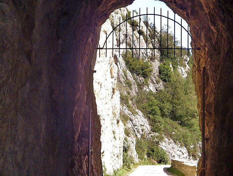
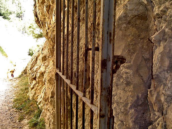
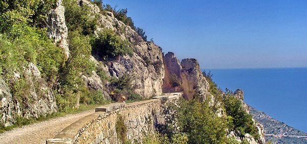
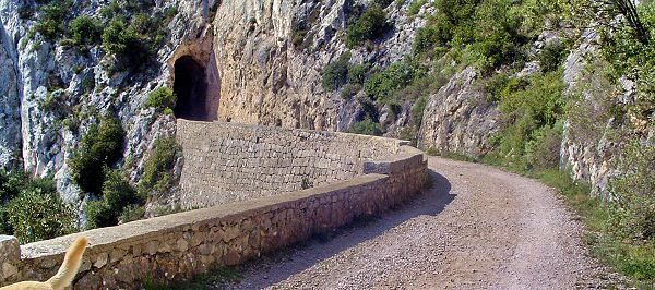
L'entrée Est du tunnel est pourvue d'une intéressante grille
The East entrance is protected by an interesting gate
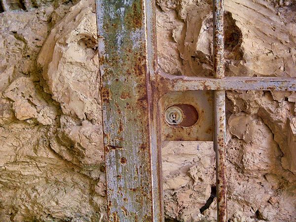
Updated : 0000-00-00
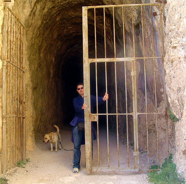
Si vous avez oublié la clé, esperez que personne ne ferme derrière vous
If you forgot the key, just hope nobody will lock behind you
Updated : 0000-00-00
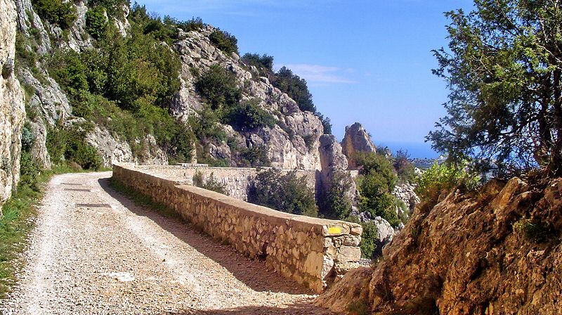
La splendide piste Simboula. Quel regret de laisser la voiture au parking
The wonderfull Simboula track and your car is sleeping in the carpark
Updated : 0000-00-00
Un à pic vertigineux. Faites très attention en vous penchant
A dizzy straight down. Be really carefull to take the pic
Updated : 0000-00-00
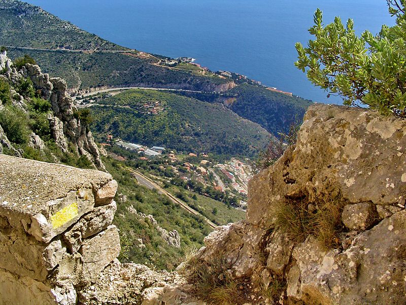
Des roches sur fond de Méditerranée
Blocks over the blue of the Mediterranean Sea
Updated : 0000-00-00
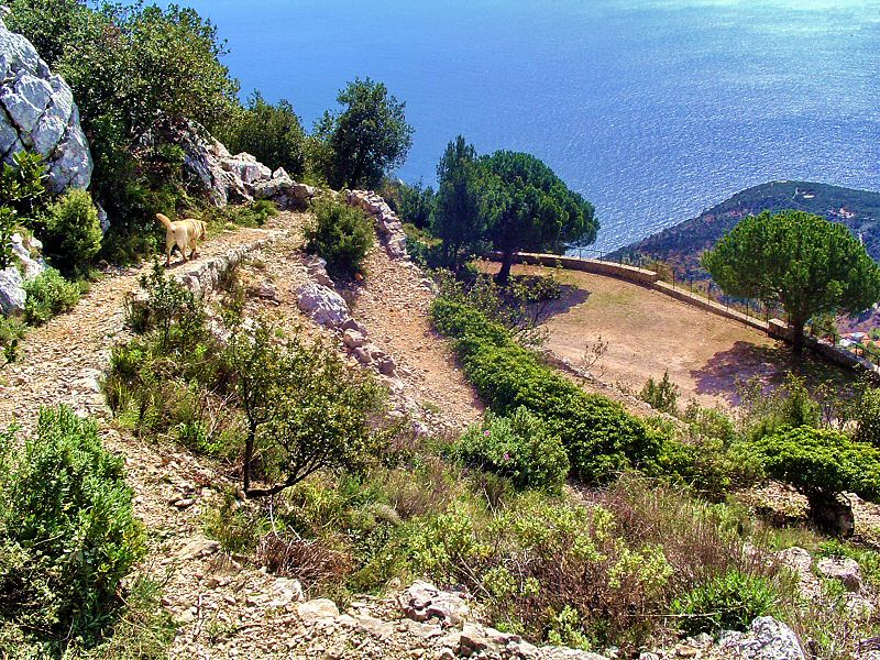
WPT9 Pointe Est de la ballade
WPT9 Esat peak of the hike
C'est à ce point que nous ferons demi-tour. Si vous êtes en vélo, à cheval ou en âne, vous pouvez continuer la piste. Notre itinéraire rebrousse chemin car il reste une petite côte finale pour retrouver la voiture dans une bonne demi-heure.
At this point we will make half turn. If you like, if you are on a bike or a horse, you an continue the track. Our hike will go back from there because you have still a good little climb to reach back your car.
Updated : 0000-00-00
Retour vers le tunnel qui se détache sombrement sur la roche claire
Way back to the tunnel visible as a black spot on the clear rocks
Updated : 0000-00-00
Updated : 0000-00-00
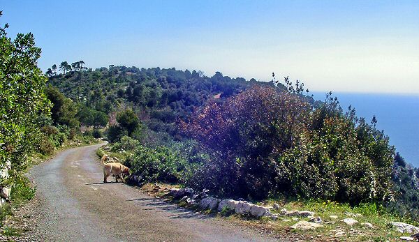
Une excellente qualité de piste pour VTT
Excellent quality of track for mountain bike
Updated : 0000-00-00
Heureusement la porte est restée ouverte
Hopefully the gate stayed opened
Updated : 0000-00-00
Après le tunnel, vous repassez au WPT8 mais vous continuez tout droit
After the tunnel, you reach again WPT8 but you continue straight on
Updated : 0000-00-00
Updated : 0000-00-00
Continuez la piste jusqu au WPT10
Continue the track to WPT10
Updated : 0000-00-00
Le Fort est à nouveau en vue
The Fort is again visible
Updated : 0000-00-00
WPT10 Fin de la piste Simboula
WPT10 end of track Simboula
Vous arrivez à la fin de la ballade. Il vous reste la petite côte à monter pour rejoindre le parc du Fort et le parking où vous avez laissé la voiture
You are now at the end of the hike. You will have to climb back to the park of the Fort then to the carpark
Updated : 0000-00-00
Updated : 0000-00-00
Formule 4 Il vaut mieux ajouter de la vie aux années que des années à la vie sitemap
|
|